How to Use Flight Radar? – A Detailed Guide
Using Flight Radar is much easier with its user-friendly interface. It features multiple tools for controlling the map. Once you use it, you will familiarize yourself with its tools over time. In no time, you will be able to run through the program with ease without even finding the need to think.
How to Resize and Drag the Map?
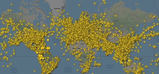
The very first step towards familiarizing yourself with the map and navigation around it is to learn how to resize and drag the map area. Normally, when you open the website, you see an airspace section covering a broad region around our location.
To make the map section smaller, you can hit the “Magnify” button, shown by a plus icon. This will give you a clear view, reducing the number of aircraft on display. If you use the service on mobile, you can zoom in or out using the touch screen.
To drag the map section to East, West, North, or South, just click and hold on the map area with your finger or mouse and drag it in your desired direction. Voila! You are done adjusting the map to track the flight you want to know about.
How to View Aircraft Data?
After spotting the particular aircraft, the next step is to view its data. To do so, you will need to hit the yellow-colored symbol representing that aircraft on the Flight Radar’s interactive map. A window will pop up with a plethora of interesting details about the aircraft.
The viewed information thus includes the destinations that the plane is flying to and from. Flight number, aircraft type, airline, etc. Scroll a bit to spot live info about the altitude and speed of the aircraft. It will also display the expected arrival time at the destination airport. Many aircraft details do feature a picture doe plane enthusiasts. On a closer look, you can even spot minor details in the pic, like painted advertising strips, red wings, and more.
How Do Targeted Searches for Regions and Airports?
If you want to explore which airplanes are flying in your region’s airspace at any particular moment, you can do that with Flight Radar. You can also browse for the details of flights at a particular airport. To do so, just enter the name of your airport or region into the search box. The map section will instantly update according to the inserted detail.
If you are unable to view your village on the map, try dragging the map until you spot the desired area. To track the civil aircraft above our region, you have to set the map section to a radius of a few kilometers around your current location.
How to Track Selected Flights?
Want to know where the specific plane flying over you is leading to? Where has it come from? Or want to know about a specific flight on which your relative or friend is traveling? It’s all feasible with Flight Radar! Instead of entering the name of the airport or region, just enter that specific flight’s number into the search box, and that’s it!
If an airplane matching your provided details is currently flying in the airspace, the map will focus on it and view all the information about your plane available at that moment.

